 |
Here begins, coming from the west, a new climate zone, which is determined by the
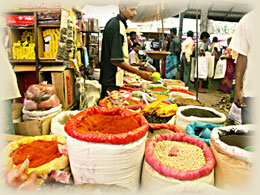
weaker northeast monsoon. Rice fields, whose opulent fertility is supported by ingenious constructed ancient and modern irrigation systems along the Mahaweli River characterizes the man-made landscape and humid tropical forest changes into savannah like jungle. Beyond of mass tourism individual travellers, nature lovers and culture-interested people will find lot of interesting possibilities. For more Details click on culture and nature pages. - Much fun! |
 |
||
| Besides its rural distinctions, Mahiangana is also a popular destination for buddhist pilgrims and an important strategic point between east- and westcoast. |  |
 |
 |
The surrounding countryside is a mix of jungle and man-made landscape. Because of less traffic, its natural beauty and its friendly residents, it is very good for exploring by cycling. In the west you can see the massive mountains of the Knuckles Range. |
|
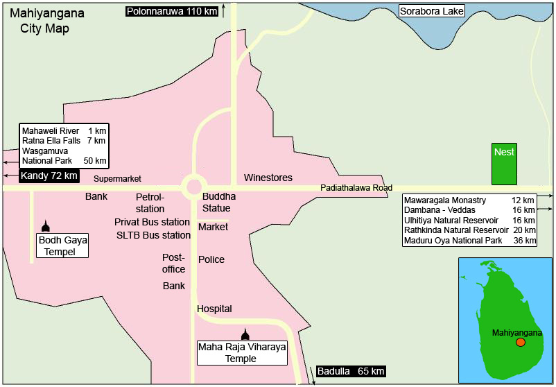
Access road: West and Northwest from Kandy A26 via Hunasgiriya (Knuckles) from Kandy via Victoria Dam Road from Dambulla A9 + B38 via Hettipola |
Km time 70 km 2:45 h 100 km 2:45 h 150 km 3:15 h |
 |
Access road: North, East and South from Polonnaruwa AB44 via Mannampitiya from Ampara A27, A5, via Padiyathalawa from Badulla (Railway) B49 |
Km time 110 km 1:30 h 120 km 2:30 h 65 km 1:15 h |
 |
||||
| back to top | ||||
|
- Copyright - The content of our website is protected ! |
||||